| Weather forecast | Web cam | Weather station | Contact us | Photo Gallery | Links | Search |
| Getting there | Nature | Culture | Epicurean living | Activities | Routes | Our hotel |
| Amiata nature |
Hiking and mountain bike
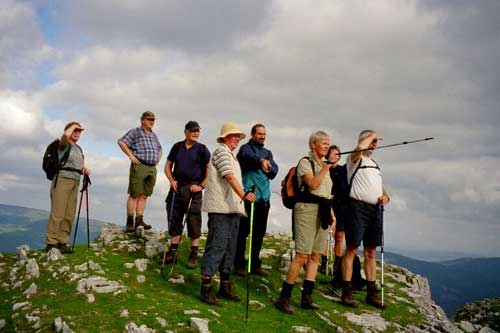
(From the Monte Labbro summit)
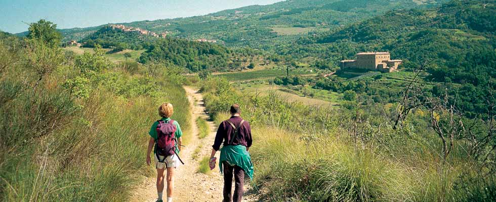
Touring Amiata
Immerse yourself in the largest beech wood in Italy
Be dazzled by the thousand colors of the forest
Hunt for wild mushrooms, strawberries, raspberries and chestnuts
Stretch out on meadows caressed by the wind
Stroll through splendid towns which ring the mountain
Take to the Amiata trials on a mountain bike:
On the Amiata Ring, 30 Km/19 miles at altitudes ranging from 850 to 1,200 meters
On the Castell’Azzara Ring, 22 Km/14 miles through the Tuscan scrub
Pass through the ancient abandoned mines
Ride alongside the ski runs
And many other options
A Mountain Enjoyed at a Human Pace
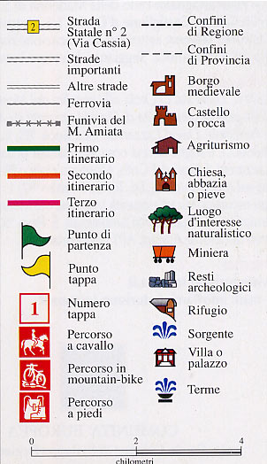
A recent network of trails crisscrosses Amiata, uniting the mountain towns between themselves and the peak, and allowing the gathering together of an extraordinary natural and cultural patrimony.At the same time, this network links up with the principle routes which pass through the rest of the Sienese and Grosseto provinces, underscoring the centrality of southern Tuscany, and lending a regional scope to the existing system of trails.The trails stretch to about 215 Km/134 miles, divided into two main routes linked to the great ring around the volcanic cone, for a total of 19 main trails which include surrounding paths.
Principle Route II from Ripa d’Orcia to Catabbio
First we cross the Gole dell’Orcia (“Orcia Ravines”), the natural borders of the Amiata massif.From Castiglione the trail follows, through a sea of woods, the Amiata slopes to the center of Vivo d’Orcia, to then reach Seggiano, then rise up to Castel del Piano and Arcidoss and proceed towards Monte Labbro (1193 meters/3,273 feet).A barren peak, this mystic place still bears signs of the “davidica” (for David Lazzeretti and, ironically, King David) experience.At Roccalbegna the main route divides into two principle roads that pass through Semproniano and then both reach Catabbio.
1 Ripa d’Orcia-Castiglione d’Orcia Map
Lenght: 4 Km/2.5 miles - travel time: 2 hours
2 Castiglione d’Orcia – Vivo d’Orcia Map
Lenght: 12.5 Km/7.8 miles - travel time: 5 hours
3 Vivo d’Orcia - Seggiano Map
Lenght: 9 Km/5.6 miles - travel time: 2 hours and 30 minutes
4 Seggiano - Castel del Piano Map
Lenght: 6.5 Km/4 miles - travel time: 2 hours and 30 minutes
5 Castel del Piano – Arcidosso Map
Lenght: 2.5 Km/1.6 miles - travel time: 45 minutes
6 Arcidosso – Podere le Capanne Map
Lenght: 10 Km/6.2 miles - travel time: 3 hours and 15 minutes
6 Roccalbegna – Santa Fiora Map
Lenght: 11 Km/6.8 miles - travel time: 4 hours and 15 minutes
7 Roccalbegna – Rocchette – Semproniano Map
Lenght: 13 Km/8.1 miles - travel time: 4 hours
8 Semproniano – Roccalbegna – Triana Map
Lenght: 13.5 Km/8.4 miles - travel time: 3 hours and 30 minutes
9 Semproniano –Catabbio Map
Lenght: 5 Km/3.1 miles - travel time: 1 hour and 20 minutes
The Monte Amiata Ring
The Amiata Ring girds the perimeter of the mountain for about 30 km/18.6 miles at altitudes ranging from 1050 to 1300 meters/ 2,900 to 3,550 feet passing through forests of beech, chestnut and oak trees: an area of incomparable beauty.Three junctions link up the principle routes to the Amiata Ring from Vivo d’Orcia to the Fonte Capo Vetra refuge, from San Lorenzo to Poggio Biello, and from Santa Fiora to Poggio Trauzzolo.
10 Castel del Piano – Arcidosso – Fonte delle Monache Map
Lenght: 11 Km/6.8 miles - travel time: 6 hours
10 Arcidosso – Rif, Forestale Capo Vetra Map
Lenght: 10 Km/6.2 miles - travel time: 4 hours and 30 minutes
10 Fonte delle Monache – Podere Cipriana – Abbadia San Salvatore Map
Lenght: 11 Km/6.8 miles - travel time: 3 hours and 30 minutes
10/11 Vivo d’Orcia – Rifugio Forestale – Abbadia San Salvatore Map
Lenght: 11 Km/6.8 miles - travel time: 3 hours and 30 minutes
12 Fonte delle Monache – Marroneto – Santa Fiora Map
Lenght: 6 Km/3.7 miles - travel time: 2 hours
Principle Route III, from Celle sul Rigo to Castell’Azzara
This is the extension of the Sienese provincial trail, which, beginning at Trequanda crosses the Sienese Valdichiana to end at the Lazio border.From Celle sul Rigo, the route cuts the northeast ridge of Amiata to Castell’Azzara, continuing on to Pitigliano and the Argentario and, with another branching off, ends at Santa Fiora.
13 Celle sul Rigo – Radicofani Map
Lenght: 12 Km/7.5 miles - Travel time: 3 hours and 30 minutes
14 Abbadia San Salvatore – Radicofani Map
Lenght: 10 Km/6.2 miles - Travel time: 3 hours
15 Abbadia San Salvatore – Piancastagnaio – Saragiolo Map
Lenght: 15.5 Km/9.6 miles - Travel time: 3 hours and 15 minutes
16 Saragiolo – Miniera del Siele Map
Lenght: 14 Km/8.7 miles - Travel time: 4 hours and 15 minutes
16 Miniera del Siele – Castell’Azzara Map
Lenght: 8 Km/5 miles - Travel time: 3 hours and 15 minutes
17 Castell’Azzara – Podere La Pinza – Podere La Roccaccia Map
Lenght: 8 Km/5 miles - Travel time: 2 hours and 45 minutes
18 Castell’Azzara – Fosso Stridolone Map
Lenght: 3 Km/1.9 miles - Travel time: 45 minutes
19 Selva – Selvena Map
Lenght: 10 Km/6.2 miles - Travel time: 3 hours
19 Santa Fiora – Selva Map
Lenght: 9 Km/5.6 miles - Travel time: 2 hours and 15 minutes